| Overview |
| How to .... |
| Grids and Datums |
| Map Images |
| Uses |
| System Issues |
MAPC2MAPC
program has an extensive list of Datums and Projections that are used
when processing maps.
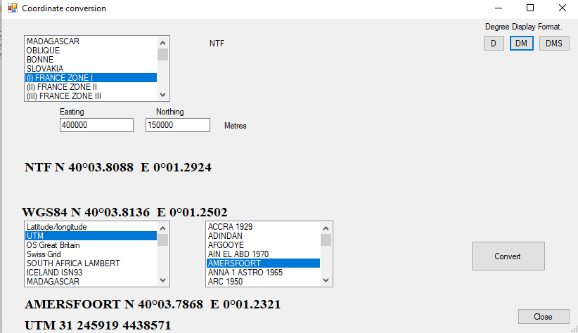
From version 578 there is a new facility to convert coordinates explicitly.
Choose the projection and, if applicable the datum of the source (in this case France Zone I), enter the coordinates and choose the projection and datum of the target (in this case Universal Transverse Mercator with the Amersfoort datum) and click Convert.
The program converst the source to Latitude Longitude with the source datum; then to WGS84; then to the target datum and finally to the target projection.
Most of the EPSG codes are available.
Note that for unregistered users this is free to try but the program must be restarted after 3 conversions.