Updated May 2021 with
latest OS and OSM data and Core Paths from some areas of Scotland; now
includes Elevation data
| Based on OS Mapping :- Every Road Every Stream Every Wood and Copse Every Building Land features : rocks, cuttings, embankments Contours Most Rights of way Tracks and footpaths View, Plan and Print with Mobile Atlas Creator and mobile apps |
 |
I have merged Opendata District Vector data with OS contour data and footpath data from Open Street Map and Rights of Way data from Local Authorities (where available). Also included are some items from Open Street Map such as footpaths where ROW data in not available, Pubs and abandoned railways
This map is available at a price of £15 download. The maps are a fraction of the price of OS maps of comparable detail. See here for some detailed comparisons. Note the level of topographical detail : streams, woods, buildings and rocks. The map can be used in on PC and MAC desktops, directly on Apps that support Mapsfroge Vector Maps, printed or extracted as raster maps for a wide range of applications.
The mapping covers the whole of England, Scotland and Wales but not Northern Ireland nor the Irish Republic. The Isle of Man and Channel Islands are not included. The map is in one section. The download size is ~1500MB. In accordance with Open Street Map rules, the maps will not be locked. You can use them on any device you have but they are not for redistribution nor onward sale. The maps are designed for hikers and bikers : they are not routable and concentrate on the geographic information with a few points of interest. Contour lines in metres are drawn from the OS Terrain 50 product
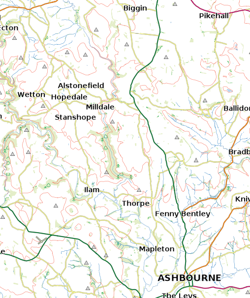
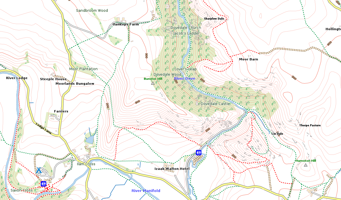
Below is an extract of the map - but you can zoom in to see more details or zoom out to see awider area. Rights of Way are shown in green (dotted for footpaths, dashed for bridleways); restricted roads ('BOATs') are shown in mauve; other paths from Open Street Map are shown in red. Rights of Way details are available for most of England and Wales (see www.rowmaps.com for details - and many thanks to Barry Cornelius for the data) . Where no Rights of Way data is available all paths are from Open Street Map and shown in red. Also from Open Street Map are selected points of interest and routes of abandoned railways. For Scotland, core paths are shown in green where data has been released by the local authorities or National Parks There is a full key here.
For details of how to handle this map got to this page. You can download a free sample from here.
Please Email if you have any queries or comments.
Click here to buy.
These maps use OS Opendata but are not endoresed nor recommended by the OS
© OpenStreetMap contributors under Open Database Licence
Rights of way data from selected Local Authorities under Open Government Licence : see www.rowmaps.com
Core paths from selected Scotland authorities