|
Digital
Maps of Britain for Walkers
If you travel by air nowadays
part of the in-flight
entertainment will be a moving map showing the plane and where it is in
the
world.
The same
technology is available for walkers at a very
affordable price.
If you
already have a smartphone then you already own enough
hardware; if you have a Garmin GPS device then that, too, will probably
work.
But you
need a map to show you where you are and where you have been.
Google
Maps (and most of the others – Bing, Apple, etc) will
show you urban features like the nearest Starbucks or ATM. They may
show some
footpaths but they probably won’t show contours, rock features or
summit heights.
For
these features the Ordnance Survey excels. Their
products are sold by companies such as Memory-map, Viewranger, Mapyx
and by themselves.
If you can afford them they are excellent but they are usually
restricted to a
single device and there are often limits on printing.
For many
years, the OS were very protective of their
copyright. In 2010 they relaxed this with the release of Opendata
mapping with
a range of features but still not really competing with the Landranger
and
Explorer products.
Meanwhile,
Open Street Map has been developing as a
‘crowdsourced’ map where contributors record their own tracks and
upload them
as roads/footpaths/canals or whatever.
Local
Authorities must, by law (except in Scotland), maintain
‘definitive maps’ of rights of way.
Many of these are now released on an Open Government Licence.
Putting
this all together it is possible to make a map for
walkers that gives you almost everything from the OS Explorer mapping.
The main
thing missing are property boundaries (fences, hedges etc) and Rights
of Way where the Local Authority has not released the data. If you can
manage
without these, read on…..
As a
walker myself (most of the Pennine
Way in 1966) and
retired IT professional I have been working on Digital Mapping for
several
years. (A software program has over 3000 users in over 60 countries.) I
have
assembled Britain maps for walkers with a combination of data from the
OS, Open
Street Map and Local Authority Rights of way data. The mapping can be
downloaded to a mobile device at home so does not need 'mobile data'
coverage when on the trail. It can also be used on desktop
computers.
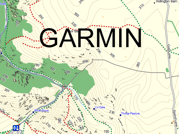
The
mapping is available in two forms. For Garmin Mapping
units (Dakota, Montana, some Etrex, etc) that can display maps and have
memory
space (about 1GB) or a memory card then a single map covering the whole country is
available for £20 Black Friday offer price £10. This is a 'native' Garmin map, not a Custom Map nor
Birdseye.
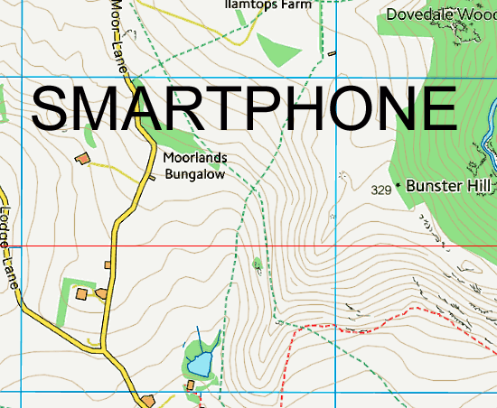
For
Smartphones, the mapping is available is seven areas for
£6 each or £25 for the whole of Britain. It is in a form suitable for
several
popular applications but free software will convert it for many more.
Once downloaded they are yours to keep - you can use them on any compatible device that you own. Questions ? please Email me.
Click
one of the maps below for more…….
|